Cookies

We use essential cookies to make our site work. We'd also like to set analytics cookies that help us make improvements by measuring how you use the site. These will be set only if you accept.

For more detailed information about the cookies we use, see our cookies page.

Essential Cookies

Essential cookies enable core functionality such as security, network management, and accessibility. For example, the selections you make here about which cookies to accept are stored in a cookie.

You may disable these by changing your browser settings, but this may affect how the website functions.

Analytics Cookies

We'd like to set Google Analytics cookies to help us improve our website by collecting and reporting information on how you use it. The cookies collect information in a way that does not directly identify you.

Third Party Cookies

Third party cookies are ones planted by other websites while using this site. This may occur (for example) where a Twitter or Facebook feed is embedded with a page. Selecting to turn these off will hide such content.

Skip to main content

Hoddesdon 2 Himalayas

Our Hoddesdon 2 Himalayas project (H2H) was inspired from the BBC documentary The Highest Classroom on Earth.

The idea first came about at the beginning of 2015 when the club decided to raise the funds to take 10 local students with 2 mentors from the local area and we invited a number of local schools to get involved. The John Warner School and Sheredes Secondary school bought into the idea and together we developed the project. The earthquake in April 2015 set back our plans but we decided to add on a community project to work in a local school. We are currently working on further details of the community project and this will be published over the coming months. Each of the students selected has taken a commitment to work with the club over the coming 12 months to help us raise the necessary funds, participate in the project organisation, training plans and assist with the running of fundraising events that the club may organise.

Why are we doing this and what do we hope to achieve ?. Well please take a few minutes to watch the video below, as we hope this will explain far better than we can with words. 

As we progress our journey we will be updating this site as well as posting regular updates on our facebook page.

 https://www.facebook.com/Hoddesdon2Himalayas/

At present there is a group of 23 going on the trip comprising 6 club members, 10 local students aged around 17, 2 school mentors plus friends and supporters of the club.

Fund raising is through locally run events as well as some sponsorship from local business which include to date.

Visionary Accountants: www.visionaryaccountants.co.uk

Pro Sports Kit UK:  www.prosportskit.uk/

PSL Automation: www.pslltd.com

If any local business would like to get involved please contact us at john.recruitment@mail.com 


Our Inspiration

Some facts about Everest Base Camp

From Wikipedia, the free encyclopedia

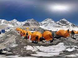
Everest Base Camp is a term that is used to describe two base camps on opposite sides of Mount Everest. South Base Camp is in Nepal at an altitude of 5,364 metres (17,598 ft) (28°0′26″N 86°51′34″E), and North Base Camp is in Tibet at 5,150 metres (16,900 ft)[1][2][3] (28°8′29″N 86°51′5″E). These camps are rudimentary campsites on Mount Everest that are used by mountain climbers during their ascent and descent. South Base Camp is used when climbing via the southeast ridge, while North Base Camp is used when climbing via the northeast ridge.[4]

Supplies are shipped to the South Base Camp by sherpas or porters, and with the help of animals, usually yaks. The North Base Camp has vehicle access (at least in the summer months). Climbers typically rest at base camp for several days for acclimatization to reduce the risks and severity of altitude sickness.

South Base Camp in Nepal[edit]


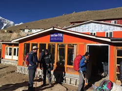
Short Rest on Everest Base Trail

The Everest Base Camp trek on the south side is one of the most popular trekking routes in the Himalayas and is visited by thousands of trekkers each year. Trekkers usually fly from Kathmandu to Lukla to save time and energy before beginning the morning trek to this base camp. However, trekking to Lukla is possible. There are no roads from Kathmandu to Lukla and as a result, the only method of transporting large and heavy goods is by plane.

In 2015, it was noted that about 40,000 people per year take the trek from the Lukla airport to the Nepal Everest Base Camp.[5]

Everest Base Trek Route Map from Nepal side

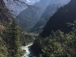
From Lukla, climbers trek upward to the Sherpa capital of Namche Bazaar, 3,440 metres (11,290 ft), following the valley of the Dudh Kosi river. It takes about two days to reach the village, which is a central hub of the area. Typically at this point, climbers allow a day of rest for acclimatization. They then trek another two days to Dingboche, 4,260 metres (13,980 ft) before resting for another day for further acclimatization. Another two days takes them to Everest Base Camp via Gorakshep, the flat field below Kala Patthar, 5,545 metres (18,192 ft) and Mt. Pumori.

On 25 April 2015 an earthquake measuring 7.8 Mw struck Nepal and triggered an avalanche on Pumori that swept through the South Base Camp.[6] At least 19 people were said to have been killed as a result. Just over two weeks later, on May 12, a second quake struck measuring 7.3 on the moment magnitude scale. Some of the trails leading to Everest Base Camp were damaged by these earthquakes and needed repairs.